Welcome to our store!

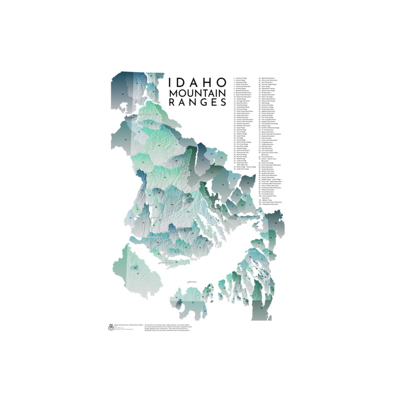
AA TopoIdaho Mountains MapA relief map of all the mountain ranges in Idaho. Defining the edges of a mountain range is subjective; this data, courtesy of USGS, defines them based primarily on topographic breaks, and secondarily on drainage patterns.All maps
A relief map of all the mountain ranges in Idaho. Defining the edges of a mountain range is subjective; this data, courtesy of USGS, defines them based primarily on topographic breaks, and secondarily on drainage patterns.
All maps are printed locally in Boise, ID on fine art paper
Dimensions: 13 x 19 inches
Map not intended for navigation. See store for details.


Reviews
There are no reviews yet.